名称:
Martensville 69 acs Grain Farmland
位置:
Corman Park Rm No. 344
名称:
Martensville 69 acs Grain Farmland
位置:
Corman Park Rm No. 344
基本信息
地产类型:农场
地产类型细分:谷类
建筑物类型:
建筑物风格:
建造时间:
出售:土地
地下矿产权:
最近的村镇:Martensville
地块信息
编
号 |
RM |
地块编号 |
土壤
等级 |
评估价 |
地税 |
耕地
面积
英亩 |
非耕
面积
英亩 |
天然
草地
英亩 |
总面积
英亩 |
| 1 |
Corman Park RM No. 344 |
344 |
120544927 |
15-6-38-5-W3 |
|
97,700 |
|
67 |
3 |
0 |
69 |
| 2 |
Corman Park RM No. 344 |
344 |
203288654 |
16-6-38-5-W3 |
|
0 |
|
0 |
0 |
0 |
0 |
|
合计 |
|
97,700 |
|
67 |
3 |
0 |
69 |
地块描述
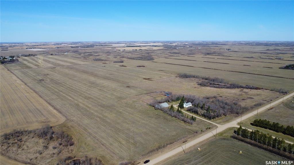
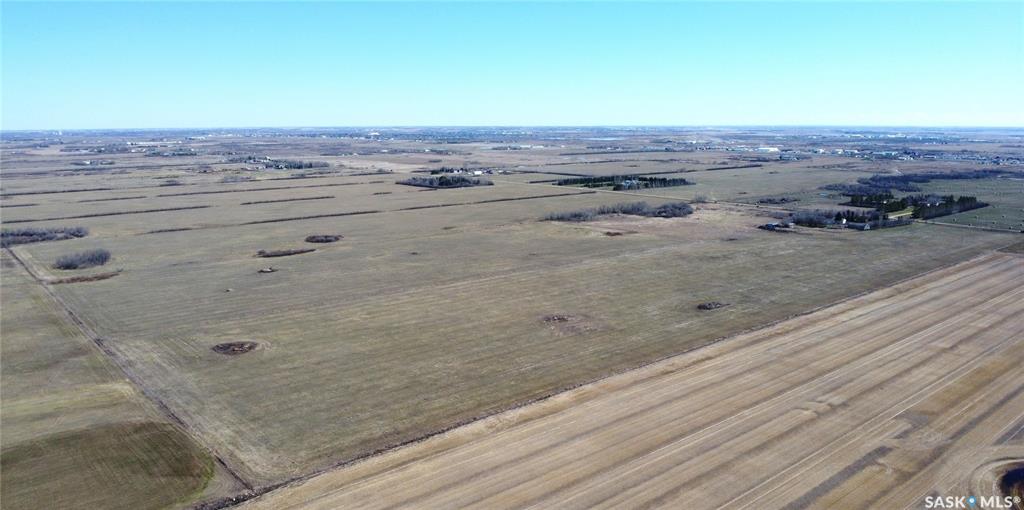
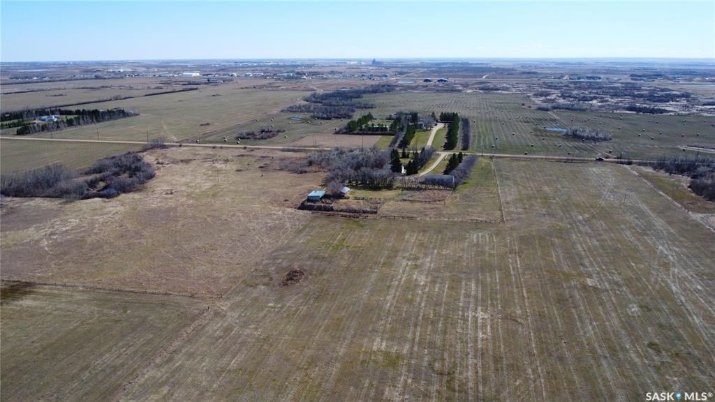
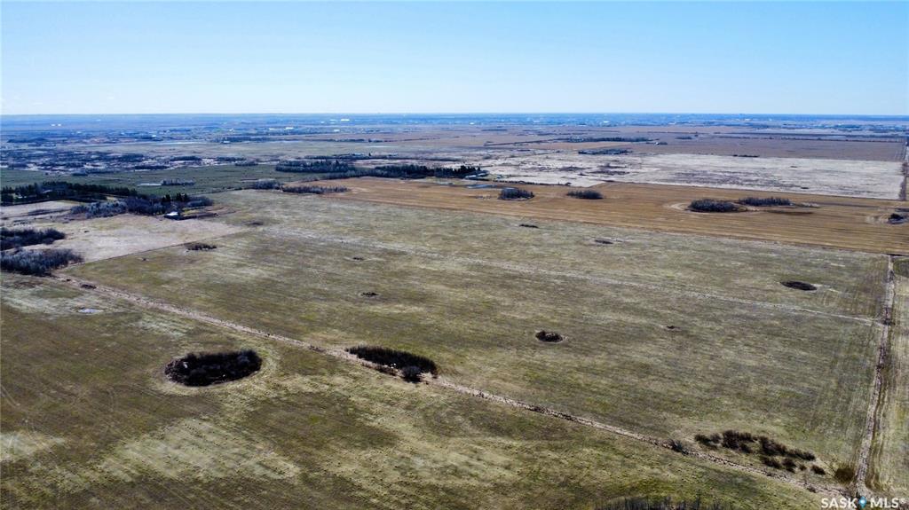
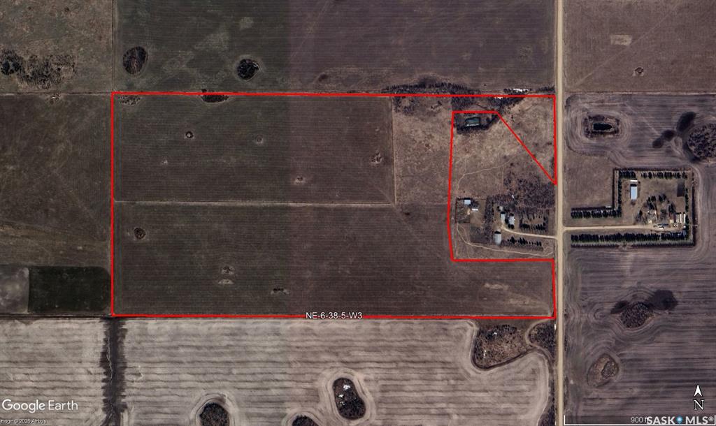
This 69-acre parcel of farmland is located only 7 km from the north end of Saskatoon and 7 km southwest of Martensville. This parcel has tremendous potential being in the Saskatoon North Partnership For Growth (P4G) district and land is zoned Agricultural District 2 (DAG2). The purpose of the DAG2 District is to accommodate extensive and intensive agricultural activities in areas designated for future urban growth. The zoning district provides for a range of complementary uses that are compatible with agricultural and non-agricultural land uses in close proximity to the P4G Urban Municipalities while supporting the diversification of agriculture.
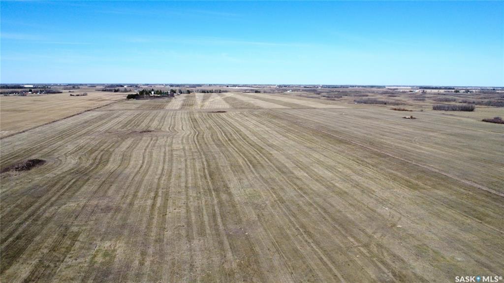
The grain farmland is comprised of a loamy sandy loam texture and is predominantly cultivated (96%). SAMA indicates that there are 67 cultivated acres, and 3 acres of wetland/bush.
There are moderate stones, and the topography of the land is level to nearly level.
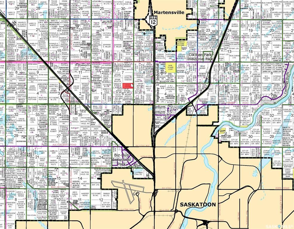
Access
The property is easily accessed with Range Road 3055 running north-south on the east perimeter of the land. Directions to the property from the north: 1.6 km west of Hwy 12 on Township Road 382 (Lutheran Road) and 1.6 km south on Range Road 3055. From from the south: 1.6 km west of Hwy 12 on Township Road 380 and 1.2 km north on Range Road 3055.
Farmland & Price Summary
1 parcel
69 title acres (ISC)
SAMA Information
70 total acres
67 cultivated acres
3 wetland/bush acres
$97,700 total 2025 assessed value (AV)
$223,314 average assessment per 160 acres
38.8 soil final rating (weighted average)
$1,100,000 Farmland Price
$15,903 per title acre (ISC)
$16,418 per cultivated acre (SAMA)
11.26 times the 2025 assessed value (P/AV multiple)
$1,100,000 Total Price
这片占地69英亩的农田距离萨斯卡通北端仅7公里,距离马滕斯维尔西南7公里。该地块位于萨斯卡通北部发展伙伴关系(P4G)地区,具有巨大的潜力,土地被划为第2农业区(DAG2)。DAG2区的目的是在指定用于未来城市发展的地区容纳广泛和密集的农业活动。分区区提供了一系列互补用途,与P4G市区附近的农业和非农业土地用途兼容,同时支持农业多样化。
粮食农田由壤土砂壤土质地组成,以耕种为主(96%)。萨省资产评估管理机构显示有67英亩耕地,3英亩湿地/灌木。
这里有中等大小的石头,地势平坦到接近平坦。
访问
该物业很容易通过3055号山脉公路到达,该公路在土地的东周南北延伸。从北部到该物业的方向:12号高速公路382(路德路)以西1.6公里,Range Road 3055以南1.6公里。南起:12号高速公路380乡道以西1.6公里,Range Road 3055以北1.2公里。
耕地及价格汇总
1个包裹
69产权英亩(ISC)
萨省资产评估管理机构信息
70英亩
67英亩耕地
3英亩湿地/灌木
2025年评估价值总额$97,700
每160英亩平均估价$223,314
38.8土壤最终等级(加权平均)
110万美元农田价格
每产权英亩15,903美元(ISC)
每英亩耕地16,418美元(萨省资产评估管理机构)
11.26倍2025年评估值(市净率倍数)
总价110万美元
卖方中介:Hammond Realty
萨斯喀彻温省房地产经纪人协会IDX 互惠房地产数据信息是根据 SRA 的 MLS® 数据访问协议显示,其版权属于萨斯喀彻温省房地产经纪人协会。
以上信息来自被认为可靠的来源,但未经独立验证不应依赖。
此处提供的信息仅用于一般目的,本公司不提供任何保证。
商标由加拿大房地产协会 (CREA) 拥有和控制,在许可下使用。
本网站上显示的萨斯喀彻温省房地产经纪人协会的 MLS® 系统数据每10分钟刷新一次。
萨斯喀彻温省房地产经纪人协会IDX 互惠房地产数据信息是根据 SRA 的 MLS® 数据访问协议显示,其版权属于萨斯喀彻温省房地产经纪人协会。
以上信息来自被认为可靠的来源,但未经独立验证不应依赖。
此处提供的信息仅用于一般目的,本公司不提供任何保证。
商标由加拿大房地产协会 (CREA) 拥有和控制,在许可下使用。
本网站上显示的萨斯喀彻温省房地产经纪人协会的 MLS® 系统数据每10分钟刷新一次。